Posts

Projections Part 1 Intro to GIS

Image
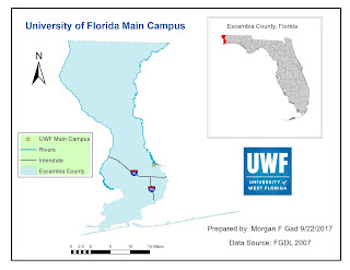
In this week's lab exercise we learned about different coordinate projections and how to choose the most appropriate one to display the area we want to highlight most accurately. We created three different maps with a table showing county comparison by area in square miles.

GIS Sharing Week 4

This week we created map packages for sharing as well as troubleshoot errors that may arise. The information provided went more extensively into spatial reference and appropriate situation to use them as far as the area of the earth you may be working with. I created a Top 10 list of water-based Florida State Parks based on a  web sites criteria (I have not visited them all to be able to rank them) and provided url links to them all. I input all of the information into a excel spread sheet that could then be used in other applications. I developed the map a little further in both ArcGIS and ArcMap. Link to ArcGIS: https://arcg.is/08OHuS

GIS Cartography Week 3

Image

Own Your Map

Image
This week the topics that were covered were map creation and design skills. I learned the difference between data view and layout view in ArcMap and what tools were available to work in both of them. We learned about and added the essential map elements, how to build definition queries, as well as editing metadata. The following is a map showing essential map elements:

ArcGIS Overview Map

Image
In our first week we were asked to create a map using basic GIS tools and views. We added data in ArcMap and used tools to create a map showing countries by population: