Posts

Showing posts with the label Remote Sensing 4035

Image Enhancement Module 6 Remote Sensing 4035
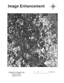
Image
Module 6 lab took us the through the use of many different types of filters in order for a user to sharpen or make prominent different features that may be contained in an image. The example below if the sharpened Fourier filter enhancement. It is not as clear as I would like it to have been but this filter is going to take a lot of practice to use effectively.

Module 5a Erdas Imagine RS 4035

Image
This week we worked in Erdas Imagine to manipulate raster images. It was interesting learning the different applications you can use as opposed to Arc Mapping. I enjoyed being able to change the spectral bands in order to change the topographical features that you wanted to stand out.

Module 2 Lab 4035

Image
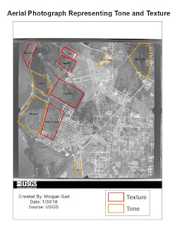
In module two be were asked to create three maps identifying texture and tone, shape and size, and distinguishing between true color and false color. Below are my three and the last is incomplete and some labeling is obviously off but was not able to figure out how to fix it before images due.